


Similar Items
Maps of China, South Korea, and Japan
Artwork Details
Dimensions:
48 x 36 cm
Medium:
Paper
Artwork Description
Medium: Paper
Dimensions: 48 x 36 cm
Condition: Good condition
Description:
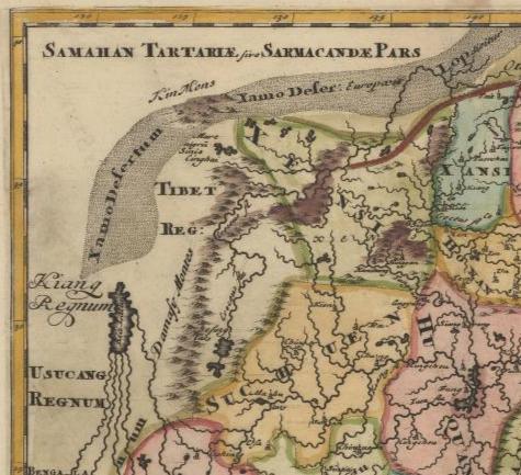
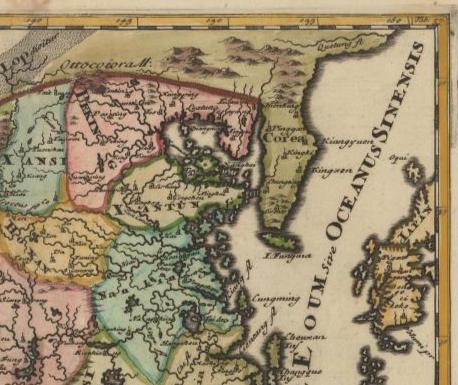
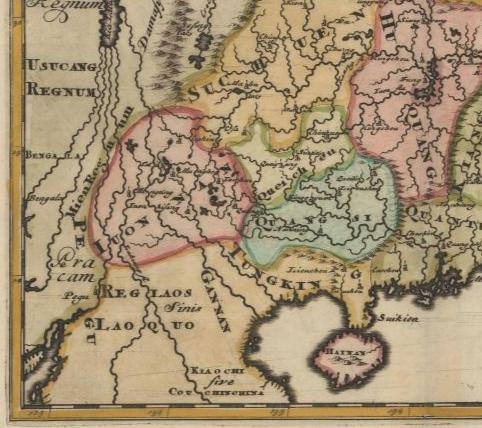
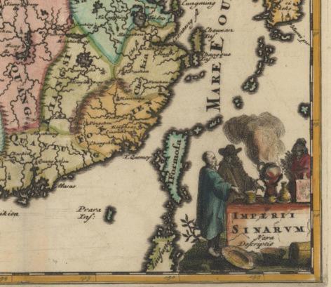
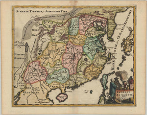
This detailed map, attributed to Philip Clover and edited in 1697 from the Introduction to University Geography, is a hand-colored representation of East Asia, focusing on China, Korea, Japan, and surrounding areas. The map draws from the significant Martini/Bragu map of the Chinese Empire and highlights numerous provinces and cities, including those in the interior regions. The Great Wall is prominently depicted along the northern border. A large, imaginary inland lake marks the headwaters of five southern rivers, identified as Kiarakis. The map extends to Taiwan, parts of Korea, Japan, and Laos. Notably, the map includes the name "Khatush," referencing a Jesuit presence. The work is an excellent example of 17th-century European cartography that combines both geography and artistry.